|
Plex.Earth Tools for AutoCAD 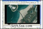
|
Plex.Earth Tools is a great solution for incorporating aerial imagery and terrain, and connecting between AutoCAD and Google Earth. A plugin created with many advanced mapping techniques, giving you the ultimate interface to place your drawings in the real world. Using advanced mapping techniques, this AutoCAD plug-in gives you the ultimate interface to place your drawings in the real world.
Professionals are able to work with the most innovative and comprehensive solution to achieve top design and unique benefits in their projects, covering such fields as:
* Transportation
* Road Design
* Land Development
* Water Management
* Power Projects
* Urban Planning
* Environmental Projects
* Landscape Design
* Geology
* Forestry
* etc.
Plex.Earth connects your AutoCAD with our Web Services in order to provide you a set of unique features in order to enhance your design, boost your productivity and impress your customers.
Plex.Earth Tools for AutoCAD Features:
1. Create mosaics and import color imagery from Google Earth right into AutoCAD, in order to:
* Cover regions of any shape (rectangular and polygonal),
* Create imagery bands along corridors, for the design of roads, highways, railroads, canals, rivers or any other linear feature.
2. Automatic export of World Files (.jgw, .tfw, .pgw, .bpw, .gfw) to transfer imagery mosaics into any CAD/GIS program
3. Export geo-referenced images and maps from AutoCAD to Google Earth
4. Publish to Google Earth whole drawings or selected objects from AutoCAD, including hatches, texts, blocks, 3d faces, 3d solids etc. The published elements are grouped automatically per layer for easier access and manipulation in Google Earth
5. Create placemarks, polygons and paths in Google Earth simply by drawing them inside AutoCAD
6. Choose placemarks' icons by loading your own images, by choosing one of the icons in the pre-defined collections or by using by default the point style which are defined in the drawing
7. Digitize objects and geographic entities through the CAD system we have developed to work on top of Google Earth
8. Import terrain points from Google Earth, inside a grid which can be defined precisely (origin, rotation and density/intervals) and limited to the boundary of the project site
9. Embed your own on-site surveying data to enrich and correct inaccuracies of Google Earth terrain, in order to precisely define the terrain features of your project
10. Automatically create contour lines and triangulations (3d faces) directly from the terrain points imported by Google Earth
11. Create surfaces using surveying or design data (points, breaklines, elevation texts, outer and inner boundaries)
12. Build contour lines at custom major and minor intervals, from any surface or other triangulation
13. Calculate the volume between surfaces or between a surface and a plane
14. Retrieve elevations to AutoCAD points and 3d polylines, from any surface
15. Insert customizable labels for surfaces and volumes, either in positions you select or on a grid you define
16. Dynamically read elevation, slope and direction in any position on a surface or triangulation, with the Inquiry tool
17. Work with surfaces created in AutoCAD Civil 3D or with triangulations from third party programs, even if you are working in the basic AutoCAD
Requirements:
* .NET Framework
* Google Earth
* AutoCAD
Limitations:
* 40-image limit
The license of this software is Free Trial Software, the price is $109.00, you can free download and get a free trial.