|
GPicSync 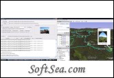
|
GPicSync automatically geocode pictures from your camera and a GPS track log. GPicSync is a smart and reliable application that automatically inserts location in your photos metadata so they can also be used with any geocode aware application like Picasa /Google Earth, etc.
GPicSync stands for G:GPS Pic:Pictures Sync:Synchronization.
Features:
1. Features:
2. automatically geocode your photos (in the EXIF header)
3. use a GPS tracklog in the GPX format or NMEA format (multiple selection possible)
4. Support elevation data if present in the tracklog
5. create a Google Earth KML file to directly visualize the geocoded photos and track in Google Earth
6. create a Google Maps file to publish your pictures and track on the web (more)
7. Automatically associate audio or video files in Google Earth and Google Maps
8. create a Google Earth KMZ file (containing your geolocalized pictures and tracklog).
9. add additional geonames and 'geotagged' metadata (for automatic tagging in Flickr for example) and create an automatic IPTC caption (more)
10. manually write latitude/longitude in a picture EXIF or a selection of photos
11. handy tools integrated (Time correction tool, EXIF reader, GPX inspector, rename pictures with date/location,)
12. supports Jpeg pictures and main RAW files format (more)
13. software available in English, French, German, Italian, traditional and simplified Chinese, Catalan, Russian, Spanish, Polish, Portuguese and Czech (see translations)
Few examples of pictures geolocalized with GPicSync:
* Google Maps export from GPicSync: bike ride (see GoogleMapsExport)
* Audio or video feature a test example
* A bike ride in the vignard as seen in Yahoo maps of Flickr or the exported kmz file from Picasa (opens in Google Earth)
* One of my lunch breaks geolocalized (as seen in loc.alize.us which use Flickr and Google maps)
* Picassa kmz exports of some of my bike rides on a 'My maps'(see tutorial)
* A Google Earth KMZ file around Strasbourg (generated by GPicSync 'KMZ Generator' tool)
* First test while mountain biking (as seen in loc.alize.us)
The license of this software is Free, you can free download and free use this wireless communication software.