|
Cartopro Evolution 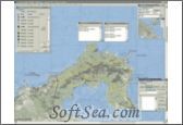
|
Create, modify and save routes, tracks and waypoints iwth Cartopro. It works with any scanned map. You will be able to transfer your data between your PC and your GPS. Tracks and waypoints from many others software can also be converted.
Cartopro Evolution Features:
1. Scan your maps directly from Cartopro
2. Show on a larger scaled map the circumference of all your other maps
3. Find the right coordinate format on the World map
4. Add pictures and drawings to your maps
5. Show your Maps and Point your data on Google Earth
6. Calibration is Easy and accurate in 2 points. 1 minute guaranteed. For very poor quality maps, visual modifications can be made manually
7. Large number of Datums available. You can add Datuns manually.
8. Click any position on a map to obtain a list of all your other maps where to show this place.
9. Allow you to know the exact coverage of map that you have and to open one of them if desired.
10. Import and Export multiple Cartopro calibrated maps. You can import or export an entire DVD for example.
11. Copy and past maps images between Cartopro and other softwares. From Internet or Photoshop for example.
12. Create, modify Routes, Tracks and Waypoints by simple clicks. You can manage as many Routes, Tracks and Waypoints your GPS own at the same time.
13. Set or modify all parameters of any point in editors of Waypoints Tracks and Routes. (By click on map or by typing on the keyboard) Coordinates, Name, Elevation, Symbols etc ...
14. Click in the list of Waypoints Tracks or Routes in edition to open a list of the possible maps where to display them. Click in the list to open the map. All data will remain displayed on the new map.
15. Display independently as much of other Waypoints Tracks or Routes that you want. These displayed data can be transferred for edition from a simple click.
16. You can see properties of all displayed points by simple click on it.
17. Use Waypoints as comments associated with your track. Click then hit "c" on the map to add a comment
18. Improve the color and contrast quality of your map by changing the color histogram. Powerful and Simple
19. Tool of transformation for almost any list of coordinates into Track or Waypoints. Can be used to convert tables, copy of Internet pages or data files like: OziExplorer, Fugawi, Alpenverein, Kompass, MapSource, CartoExplorer
20. Point your positions from Cartopro to Google Earth.
21. Use waypoints to calibrate your Map.
22. Create Route Plan with comments, references, distances between waypoints, heading (true and magnetic) To use by foot with a compass or just to indicate the way to follow by car ...
23. Create Flight Plan with distances between waypoints, heading, magnetic tracks radio frequencys, comments etc.
24. Insert images, texts and drawings on your Maps. You will be able to print them in a pdf file then to transmit the file by e-mail to your companions of race
25. Transfer Routes Track and Waypoints files. Cartopro => GPS, GPS => Cartopro
26. Re-assembe your maps scanned by pieces.
27. Visual environment even for large maps.
28. Help at any levels, full of information.
29. Printing of the map in A4 or A3 with indexed Grid and Zooms. Visual and useful.
30. Tracking software . Interfaces [Nmea 0183, Garmin Serial, Garmin USB]
31. Save and display your track while navigate, save mob point - m.o.b. = Man Over Board
32. In tracking mode, the following map is opened automatically
33. Interactive graphs for Speeds and Altitudes with slopes etc.
34. Support common units like English, nautical and European
35. Automatic calculation of surface for Tracks. Different units available. Calculate the area of a field, etc
36. Automatic calculation of the length of Routes and Tracks. Length of your trip, p?rimeter of a field, etc
37. Simulate displacements of several GPS based on the recorded tracks.
38. Import and export Cartopro maps with their calibrations. Import and export by list like a whole DVD for exemple.
39. Importation of TTQV maps on CD. E xtension .bmp .png .tif .jpg except pny protected format
40. Map of the region preselected with easy opening.
41. The map of the world allow you to see the position of your maps and to open them by simple clicks on it.
42. The map of the world give you an interactive tool to find the right format of your U.T.M. co-ordinates.
43. Routes, Tracks and Waypoints are text formated. They have markers to allow their treatment in Excel or other spreadsheet tool.
44. Symbols are Icons. You can modify them.
45. Simple and reliable.
46. All is calculated, no approximation. Full accuracy.
The license of this software is Free Trial Software, the price is EUR69.00, you can free download and get a free trial.